
Five Dubuque Postal Areas
The official Iowa Department of Public Safety city and ZIP table associates five codes with Dubuque. It does not assign neighborhood borders or post-office station names. USPS live results remain the last check for a current address, preferred city name, and delivery use.
| ZIP | Places in official local sources | Delivery use | Dubuque note |
|---|---|---|---|
| 52001 | Dubuque; also Dubuque/Sageville | USPS delivery code | May extend beyond incorporated Dubuque |
| 52002 | Dubuque and Asbury | USPS delivery code | Postal city and assessor jurisdiction can differ |
| 52003 | Dubuque city addresses | USPS delivery code | Not a ward or neighborhood boundary |
| 52004 | Dubuque county mailing addresses | Live type not verified | Do not assume all uses are boxes |
| 52099 | Dubuque in state tables | Listed as Unique in an official appendix | No residential area should be inferred |
This conservative postal inventory does not borrow third-party demographic boundaries. The evidence supports the five-code set, the 52001 and 52002 overlaps, and a unique-use label for 52099. It does not support invented station names or a claimed residential district for every code.
Dubuque ZIP Postal Overlap
Local public-health material pairs 52001 with Dubuque and Sageville, then pairs 52002 with Asbury and Dubuque. That is direct evidence that a postal city is not proof of municipal limits. It also explains why two properties carrying “Dubuque” in an address can belong to different assessor jurisdictions.
Use the county GIS City Limits layer after the postal check. Inside Dubuque, the City Assessor handles the parcel. Outside the city but within the county, the County Assessor does. County road, small-city, precinct, and fire or ambulance district maps can add service context, but none replaces the parcel boundary.
Verify Dubuque Postal Codes
The USPS ZIP Code Lookup supports a city-and-state search as well as address-based verification. Use city and state to confirm the set associated with Dubuque, then use the complete street address for the delivery code. USPS cautions that a match does not confirm that a person or company occupies the address.
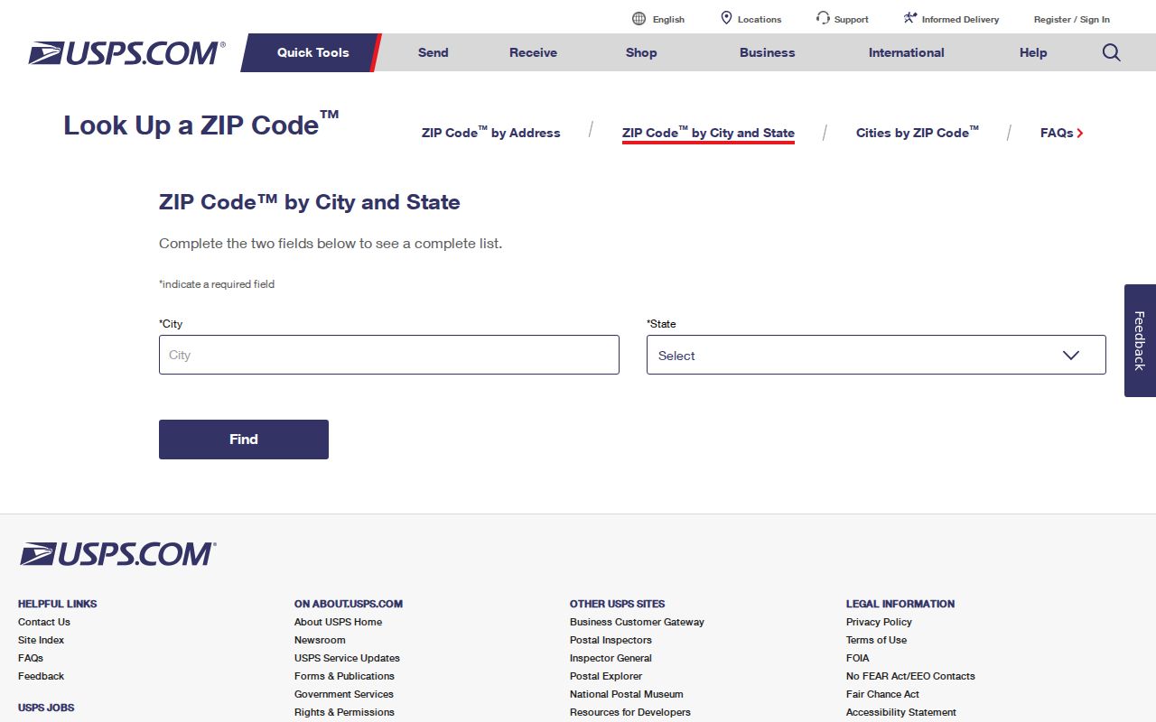
The lookup screen is the right place to resolve current preferred-city wording. It is especially important for 52004 and 52099 because the research did not expose their full current route or institution details. A sound postal directory preserves that gap instead of guessing.
Find Dubuque Records by ZIP
A postal code narrows geography, but each official system uses it in a different way. County GIS parcel and BLL layers expose postal fields that can be filtered. Beacon is the intended property portal, though its exact live filter labels were blocked during research. Iowa's voter screen accepts ZIP only as one part of a named check.
- Verify the full address through USPS and write down the current ZIP and preferred city.
- Open Dubuque County GIS and compare the parcel against City Limits. Note the PIN, situs, postal field, and owner label.
- Check the matching city or county assessment route. Do not treat tax-mail destination as an owner's home.
- For a known voter, use first and last name, ZIP, house number, and birth date in the Iowa status lookup.
- Once a ZIP has narrowed the place, use the Dubuque street directory workflow for parcel-by-parcel work.
Iowa Land Records searches by county, dates, parties, and document types rather than postal ZIP. The Recorder's legal description is also more durable than a postal label when following a deed.
Dubuque GIS ZIP Fields
The county's official BLL and parcel layers expose several address fields. Their labels matter because physical and mailing geography can diverge. A controlled query can filter one code, but an unbounded output should not be presented as a list of residents.
| Field | Record meaning | Search caution |
|---|---|---|
| SitusPostalCode | ZIP tied to physical location | Confirm the situs address is populated |
| SitusPostalCodePlusFour | More specific delivery suffix | Not a person identifier |
| PostalCode / Zip | Parcel postal field | Can include county or rural records |
| MailPostalCode | Tax mailing destination | May be outside Dubuque |
| FullSitus | Full physical parcel address | Use with PIN and map geometry |
| SitusCityName | City label attached to situs | Still compare with City Limits |
An inspected county sample returned a valid parcel PIN, owner, tax year, and ZIP while its Property Address was blank. That local quirk shows why a ZIP-only result needs a map, legal description, and record date.
Dubuque Voter ZIP Limits
The Iowa “Am I Registered?” lookup is not a ZIP-wide resident directory. It asks for first name, last name, ZIP, house number, and birth month, day, and year. A successful match confirms registration status and polling information for that named person.
Full voter-list requests are a separate route governed by Iowa Code sections 48A.34 and 48A.38 through 48A.39. Purpose restrictions, fees, format options, and confidential-address exclusions apply. Social Security, driver-ID, and protected address details are not public. Safe at Home participants receive confidential voter procedures.
Dubuque Address Labels Differ
A Dubuque postal result is one label among several. Keep each in its own column when comparing sources. Replacing a legal description with a street number, or a city limit with a postal city, creates false matches.
- ZIP and ZIP+4
- The five-digit delivery area and a four-digit add-on that narrows delivery.
- PO-box ZIP
- A code used for post-office boxes; that status must be verified live.
- Unique ZIP
- A code assigned for a special or high-volume use rather than a normal neighborhood.
- Carrier route
- A delivery path within a ZIP, not a city or parcel boundary.
The situs address identifies the physical parcel. The mailing address receives tax correspondence. The legal description identifies land in recorded instruments. The PIN keys the parcel in local map and tax systems. None, by itself, proves who currently resides there.
Dubuque ZIP History Context
Historical Dubuque directories do not always share today's postal scope. Early entries use streets and landmarks, while later volumes add numbered addresses and postal detail. A 1983 volume expressly includes East Dubuque and a Dubuque County taxpayers directory, so its name and address coverage crosses the modern city line.
Street-directory pages inside the 1856 to 1991 digital archive are a useful ZIP-free predecessor to current address searching. Confirm the scanned page because OCR can misread digits. No verified local ZIP split or realignment year was found, so a change should be tested against dated directories, maps, and USPS evidence rather than assigned a guessed date.
Correct Dubuque ZIP Mismatches
Start with the system that owns the disputed label. USPS handles delivery ZIP and preferred-city issues. City or county GIS handles mapped situs, address points, and municipal boundaries. The assessor handles tax-roll address fields, while the Recorder handles legal descriptions and recorded documents.
Give the custodian the complete address, PIN if known, field that appears wrong, source URL, and date observed. County records can also be requested in person, by phone, in writing, or electronically under Iowa Code Chapter 22. Narrow the request to a record type and date range. A source correction may not change the other systems at once because each serves a different purpose.
Dubuque ZIPs Versus City Limits
The key mismatch is simple: postal geography routes mail, while city limits assign municipal jurisdiction. The 52001 Dubuque/Sageville and 52002 Asbury/Dubuque pairings make that distinction concrete. A Dubuque mailing label can sit outside incorporated Dubuque, and one code can span several civic areas.
Boundary check. Confirm ZIP through USPS, then confirm city jurisdiction with the Dubuque County GIS City Limits layer.
Neighborhoods, conservation districts, wards, precincts, school areas, and postal codes are different geographies. Keep the map layer name and date with any claim. That makes the directory useful as a starting filter without turning it into a false household list.
Neighborhood geography supplies context that a postal code cannot. Dubuque's conservation districts include Fourth Street, Fenelon Place, Third Street, Washington, Jackson Park, West 11th, Broadway, Downtown, and Brewery. The City Neighborhood Support program separately lists association contacts for Bluff Street, Downtown, Fenelon-Hill, Langworthy, North End, Point, Tomahawk, and Valley View. Neither source is a resident roster. Use those maps to identify a relevant civic archive, permit report, historic survey, or association contact, then return to parcel and USPS records for the address itself.
Historical directory geography is wider in a different way. The 1983 R.L. Polk volume includes East Dubuque and a Dubuque County taxpayers directory. Earlier books may list people by employer, landmark, or street before modern postal detail became routine. When an old entry has no ZIP, match its street or legal parcel to a dated map first. Do not assign today's 52001, 52002, or 52003 to a past household without a source from the same period.