
Walk a Dubuque Street Directory
A street-by-street search works best as a chain, not as one broad name hunt. Ownership is public through parcel and deed records. Occupancy is harder: a tax owner may live elsewhere, and Iowa's voter tool checks a named voter rather than listing a block. Keep the date, record role, and source beside every name.
- Enter the address in Beacon, the property portal linked by both Dubuque assessor offices. Copy the parcel number, situs address, owner label, and legal description.
- Open the county Land Records map. Keep the road and nearby parcel shapes visible, then compare each address and PIN along the segment.
- Use the Iowa voter lookup only when a name, house number, ZIP, and birth date are already known. It confirms a registration match, not all residents.
- Carry the owner name and deed reference into the Recorder's Cott index or Iowa Land Records. Follow grantor and grantee roles to earlier transfers.
- For an older household, search the street pages in the digitized city directories, then inspect the scanned image because OCR can misread names and numbers.
This method separates owner, voter, permit applicant, and historic householder. Those labels should not be merged. When a search shifts from a whole road to one modern person, the Dubuque resident lookup explains name-based checks without repeating the street chain.
Dubuque Street Parcel Fields
The official county GIS service is a strong fallback when Beacon will not load. Its parcel and BLL layers expose the fields that matter in a Dubuque street directory search. A parcel is one mapped unit of land. The situs address is its physical location, while the mailing address is where tax notices go.
| GIS field | Meaning | How to use it |
|---|---|---|
| PIN | Parcel identification number | Stable bridge among map, tax, and deed clues |
| FullSitus | Physical parcel address | Places the parcel on the street |
| OwnerName | Tax-roll owner label | Starting name for the deed index |
| MailLine / PostalCode | Tax correspondence destination | Locate clue only, not proof of residence |
| Legal / SecTwpRange | Recorded land description | Finds land when an address changed |
| Deed instrument or book/page | Recorded transfer reference | Connects the parcel to Recorder files |
| Tax year, class, values | Assessment context | Dates the tax snapshot |
The parcel layer also carries homestead, acreage, districts, and deed dates. Homestead is a tax flag, not conclusive proof that a named person now occupies the property.
Browse Dubuque Streets in GIS
The Dubuque County Land Records service exposes parcels, lots, subdivisions, city limits, tax districts, survey townships, sections, fire districts, roads, and zoning layers. Zoom to a road, click each polygon, and record its PIN and physical address. The service can query and identify features, though its public map controls may vary.
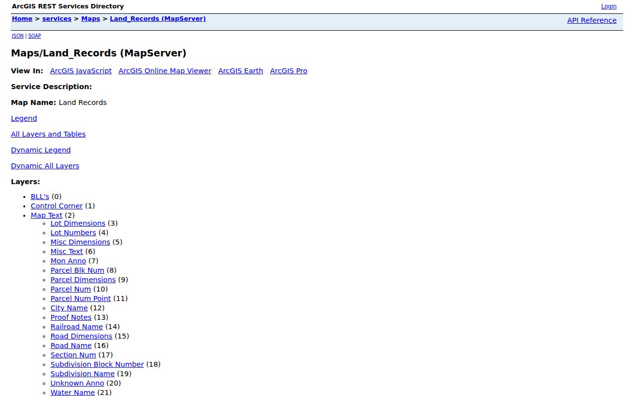
The layer list shows why the map is useful beyond a pin on a road. It can test whether the mailing city, city limit, tax district, and parcel geometry describe the same jurisdiction. County GIS warns that the system is a general index, not a survey or title opinion.
The official parcel layer provides another view of the schema and query tools.
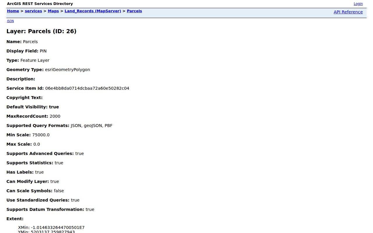
A notable Dubuque quirk appears in the inspected sample: it had a valid PIN, owner, ZIP, and tax year while the physical Property Address was blank. That is a good reason to preserve the legal description and parcel ID.
Dubuque Records Keyed by Street
No single record set is a complete street directory. The right source depends on whether the question concerns land, a transfer, work on a building, a named voter, or an older householder. Dubuque also splits assessment work at the city boundary.
| Address record | Local keeper | Useful result | Access route |
|---|---|---|---|
| Parcel and tax roll | City or County Assessor | Owner, situs, mailing, class, value, PIN | Beacon, GIS, or assessor office |
| Parcel map | Dubuque County GIS | Shape, legal, deed, ZIP, and district fields | Public ArcGIS map and query |
| Deeds and plats | Dubuque County Recorder | Parties, legal description, instrument references | Cott, Iowa Land Records, courthouse |
| Transfer books | County Auditor | Transfers and map updates by legal description | Office examination or request |
| Building permits | City Inspection Services | Address, applicant, owner, parcel, work, value | Monthly archive and request |
| Historic address entries | Carnegie-Stout and city archive | Named householders by street and year | Digitized 1856 to 1991 volumes |
The parcel number connects map and assessment data. A deed reference then reaches the legal transfer. Permits add change dates, while historic directories add time-stamped occupants. Each source remains evidence of its own role.
Dubuque Street Jurisdiction Split
The City Assessor handles property inside Dubuque city limits. The County Assessor handles property elsewhere in Dubuque County. Both link to Beacon, but a postal label alone does not decide which office holds the assessment. A 52001 address may connect Dubuque and Sageville, while 52002 appears with Asbury and Dubuque in official local material.
Turn on the GIS City Limits layer before calling an address a city parcel. The City Assessor can be reached at 563-589-4416, and the County Assessor at 563-589-4432 when the portal is blocked or a field needs explanation. The City of Dubuque GIS overview explains address, parcel ownership, buildings, and map layers.
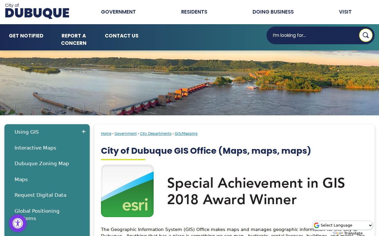
The city page helps place a parcel in municipal context. The county parcel service remains the better field-level check for PIN, deed, tax, ZIP, and legal-description data.
Follow Dubuque Street Deeds
A deed chain starts with the current owner and recording reference, not merely the typed street address. In the Recorder index, a grantor transfers an interest and a grantee receives it. Search the present owner as grantee, inspect the matching legal description, then search the seller as an earlier grantee.
- Parcel
- A mapped unit of land with its own PIN.
- Situs address
- The physical location assigned to the parcel.
- Plat
- A recorded map that lays out lots, blocks, or a subdivision.
- Criss-cross directory
- A directory organized by street or telephone rather than only by surname.
The Dubuque Recorder Cott index provides last or firm name, first and middle names, party role, date range, index type, group, and kind controls.
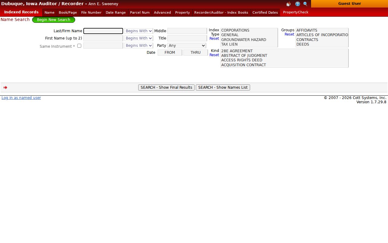
Iowa Land Records is the statewide alternate, with county, date, grantor or grantee, name, document type, sort, and image filters. Account permissions control some detail and image access. The precise online cutoff for Dubuque was not verified, so older work may require the courthouse or State Historical Society holdings.
Dubuque Street Permit Clues
A building permit can date a remodel, demolition, pool, solar project, sign, or other physical change without implying an ownership transfer. City reports may name an address, applicant, owner, business, parcel, work description, area, value, and fee. Those are distinct roles.
The Dubuque Building Permit Archive organizes published reports by date and category.
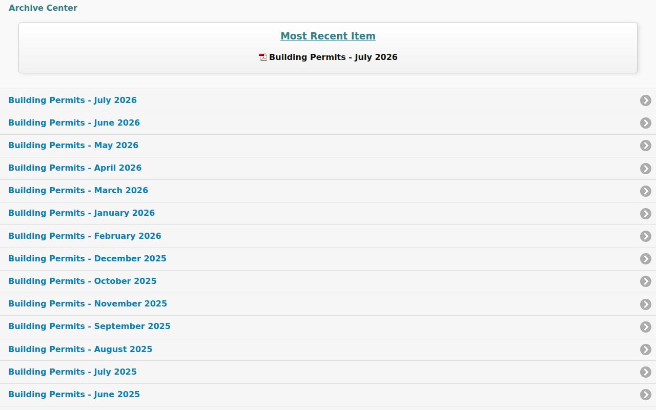
If a report row lacks the needed detail, request the permit file by address, parcel, and date. No open zoning-enforcement case search was located. Planning Services takes address-specific status questions at 563-589-4210, while releasable case logs can be requested under Iowa Code Chapter 22.
Older Dubuque Street Directory Entries
The digitized Dubuque city directory archive covers 1856 through 1991, but reverse sections differ by volume. Search the street name and number, then verify the scanned page and alphabetical entry. Early address language may use a landmark or street segment. An 1855 example says a person resided on Locust between Fourth and Fifth rather than giving a modern house number.
Later Polk volumes add numbered addresses, phone abbreviations, spouses, work, and household details. That historical shelf belongs in full on the Dubuque city directory page; for a by-address search, its key value is one dated link between a street location and a named householder.
When Dubuque Numbers Fail
No official citywide street-renumbering year was verified. Do not force an old number onto a modern parcel. Search the lot, block, subdivision, legal description, adjoining streets, and Sanborn building footprint instead. City historic surveys cover central streets, Washington, Jackson, Elm, Rhomberg, Eagle Point, Linwood, and other areas that can add context.
The Recorder's legal-description system may outlast a street name. Auditor transfer maps also record subdivision, survey, annexation, and ownership updates. When the modern portal has no hit, give the Recorder, Auditor, City Engineer, GIS staff, or Center for Dubuque History the old wording and a narrow date range.
Request Dubuque Street Records
The Dubuque County policy dated May 4, 2026 names the Auditor as lawful custodian for countywide requests. A request may be made in person, in writing, by phone, or electronically. Writing is encouraged. Identify the address, parcel, record type, date range, and whether inspection or copies are sought.
County inspection can be arranged during business hours. Electronic delivery is available when feasible, estimates and prepayment may apply, and originals stay with the county. The posted policy lists black-and-white copies at 25 cents per page and color at 30 cents, but its worksheet lists 50 cents for color. Ask for the current rate before ordering. City records route through the City Clerk or the department that holds the permit or map.
Limits of Dubuque Street Records
A public parcel roll names tax ownership, not each person who lives at the site. The mailing address may point to a business, trust, estate, or a different home. Iowa's free voter lookup needs a known name and other details; it does not print a block roster. Driver, utility, delivery, and protected voter address data are not general public street-directory sources.
Safe at Home participants use substitute-address and confidential voter procedures for safety. Never try to reverse those protections. Correct a public field through the office that keeps it, and cite the PIN, instrument, permit, or other record identifier.
Older street work also has an archive path. The State Historical Society of Iowa catalogs Dubuque County land and town-lot indexes reaching to 1834, along with deed, probate, court, naturalization, tax, and vital series. The Center for Dubuque History at Loras holds plat books from 1874, 1892, and 1906, a 1909 Sanborn map, special censuses, obituaries, and local maps. Its collections do not circulate, and scans or staff research may carry a fee. DCHS River Library & Archives offers appointment-based help with family, business, photo, contract, correspondence, and blueprint collections. These channels matter when an address predates the web parcel layer or appears only as a lot, block, landmark, or old street description.
Lawful use. Use Dubuque address records for careful personal research, and never to stalk, harass, threaten, or expose a protected person.